GEOSPATIAL BIG DATA ANALYSIS
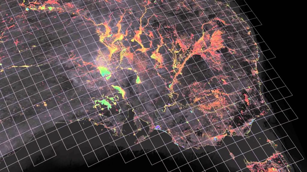
Geospatial big data analytics has received much attention in recent years for the assessment of energy data. Globally, spatial datasets relevant to the energy field are growing rapidly every year. I have analysed large, gridded datasets of outdoor temperature, end-use energy demand, end-use energy density, population and Gros Domestic Product to end with usable inputs for energy models. These measures have been recognised as a means of informing infrastructure investment decisions with a view to reaching sustainable transition of the energy sector.
I have implemented an Unsupervised Machine Learning (UML)-based approach to assess large raster datasets of 165 countries, covering 99.6% of worldwide energy users. The UML approach defines a GIS-based clustering techniques to classified raster energy data and find patterns.
GEOSPATIAL BIG DATA ANALYSIS has been used to enhance the assessment of decarbonisation pathways for technology deployment in the energy sector so that global climate targets can be more realistic met.